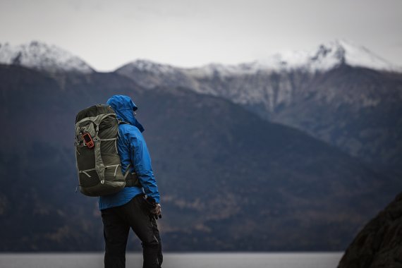
Emerging fog that makes orientation almost impossible. An avalanche of snow that buries the ski tour enthusiast. Slipping with a mountain bike, in a valley without mobile phone reception. There are a lot of scenarios in which technical supporters decide whether the situation is becoming a drama or a story to tell in a mountain hut.
A lot has already happened in recent years: the possibilities of increasing digitalization neither diminish responsibility nor decisions, but help the latter to make more conscious decisions.
Read the second part of our mini-series: This is what the new outdoor emergency call systems can do
A great advantage of digitalization is the possibility of virtually limitless capture, complex processing and extremely fast provision of data. In recent years, this has contributed to the development of numerous helpful tools that can influence the safety aspect positively even during the planning of outdoor activities.
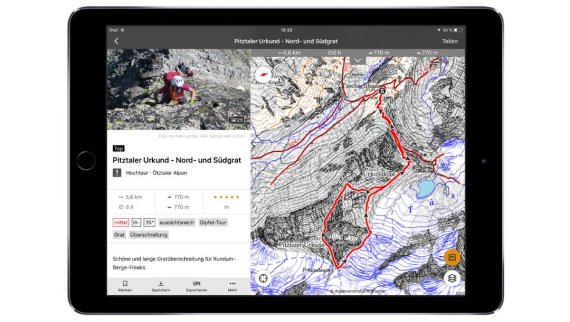
These include tour platforms such as Outdooractive, which according to its own statements, is the world's largest outdoor platform. The offers of the German, Austrian and South Tyrolean Alpine Association, Alpenvereinaktiv and the Ortovox Mountain Tour App are based on this platform.
More than 266,000 tours including detailed descriptions, navigation tracks and user experiences are already stored in the Outdooractive database. The tours including detailed map material can be stored offline on the smartphone and can be navigated safely even in poor visibility conditions thanks to the phone's GPS function. Even current weather or avalanche conditions as well as slope inclinations can be called up.
The London-based platform Fatmap offers a similar offer for freeride, ski touring, hiking and mountain bike adventures, including detailed 3D maps.

Skitourenguru's Swiss offer also helps to plan freeride tours in open terrain by assessing the risks of more than 1000 tours according to a traffic light system on the basis of personal factors, maps and avalanche reports. With just a few clicks, you can find and plan tours that are adapted to the current snow conditions and are as low-risk as possible.
"For almost 40 years I have been asking myself before the weekends what would be suitable ski tours considering the current avalanche situation report. In order to answer this question properly, the 300 daily ski tours accessible from Zurich would have to be meticulously compared using the reduction method. It's a rather laborious, repetitive job. As a software developer, it quickly became clear to me that the computer could do this much better," said Günter Schmudlach, the founder of Skitourenguru, explaining the motivation behind his idea.
Schmudlach has thus created a helpful tool for the Swiss Alpine region, especially for occasional hikers, which he has developed using the experience and results of his research work at the Swiss Institute for Snow and Avalanche Research (SLF) in Davos. In the medium term, the tool is to be extended to other areas of the Alps.
The mountain tour app from mountaineering equipment supplier Ortovox helps to assess the danger on individual slopes: Based on the key data from the current avalanche situation report for a specific region and with the aid of the integrated slope inclination meter and compass, the app gives a safety recommendation based on the data from the DAV Snowcard.
A traffic light visualizes the danger situation or the risk. However, it is up to each individual to decide whether to walk or ride the slope in question.
The second part of our mini-series: This is what the new outdoor emergency call systems can do

 OutDoor by ISPOOutDoor in transition
- Awards
- Mountain sports
- Bike
- Fitness
- Health
- ISPO Munich
- Running
- Brands
- Sustainability
- Olympia
- OutDoor
- Promotion
- Sports Business
- Textrends
- Triathlon
- Water sports
- Winter sports
- eSports
- SportsTech
- OutDoor by ISPO
- Heroes
- Transformation
- Sport Fashion
- Urban Culture
- Challenges of a CEO
- Trade fairs
- Sports
- Find the Balance
- Product reviews
- What's next
- Magazine


